The USDA definition of a vegetative filter strip is an “area of herbaceous vegetation that removes contaminants from overland flow” , generally established within and between agricultural fields and the water they drain into.
Tail water leaving a furrow irrigated field enters the filter strip between the crop field and the Little Thompson River. The established grasses slow the runoff trapping the sediments and nutrients in the field, preventing them from entering the Little Thompson River.

Filter Strip Facts
- Sheet flow must occur across the strip to slow water and disperse nutrients and sediments.
- The filter strip must be located immediately downstream of the source contaminant.
- The management goal is to improve the water quality of surrounding water ways be reducing contaminated inputs.
NRCS vs. Farmer Designed Filter Strip
- Concentrated flows must be dispersed before entering the filter strip.
- Filter strip cannot be used for equipment or livestock.
- Concentrated flow enters the filter strip and is not dispersed until the center of the filter strip.
- Filter strip opened to grazing and hay production.
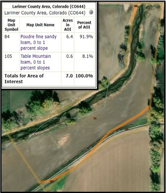
Study Site Characteristics
The field site in study borders the Little Thompson River to the north and about 40 acres of row crop furrow irrigated sugar beet production to the South. The site is located at 3.3 miles South of Berthoud Colorado at 40.280406, -105.087622 on Lempka Farms.
- Soil Type: Poudre Fine Sandy Loam
- Elevation: 4,963ft
- Mean annual Precipitation: 13 to 15 inches
- Mean annual Air Temperature: 48 to 50 degrees F
- Frost-Free Period: 135 to 150 days
- Depth to Water Table: 12 to 36 inches
The filter strip acreage is about 2 acres, 500ft long and 150ft wide. The field site was planted with cool season oats and perennial grass mixes in the spring of 2018.